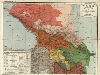
In the frames of the project “Electronic Cartography” of the National Archives of the Ministry Justice of Georgia, digital versions of the Caucasus maps were located in the Internet space.
The digital copies of the maps with high resolution are available through the official webpage of the National Archives: http://archives.gov.ge/ge/kavkasiis-rukebi and the website: https://www.flickr.com/photos/national_archives_of_georgia.
The maps have detailed annotations. The maps with various thematic are created in the 18th-20th centuries.
The project “Electronic Cartography” considers the creation of digital copies, annotate and presentation of the maps, existing in the fonds of the National Archives to the wide society.


